

To get the most value from your aerial data, you need software that turns raw drone captures into clear insights, accurate measurements, and actionable intelligence. SISO Air partners with leading software platforms to support surveying, mapping, site management, and precision data workflows to help you get the insights you need faster and more reliably.
Choosing the right drone software can transform your data into actionable insights. At SISO Air, we help you evaluate your project needs and recommend software platforms and workflows that align with your operational goals, data accuracy requirements, and team capabilities.
Talk to our team to explore Propeller Aero and Interra software options, understand licensing and workflow benefits, and determine the best fit for your data, industry, and goals.
Talk to our team to explore Propeller Aero and Interra software options, understand licensing and workflow benefits, and determine the best fit for your data, industry, and goals.

M-F: 8:00 AM - 5:00 PM
All Rights Reserved | SISO Air | Privacy Policy| Powered by Aletheia Digital
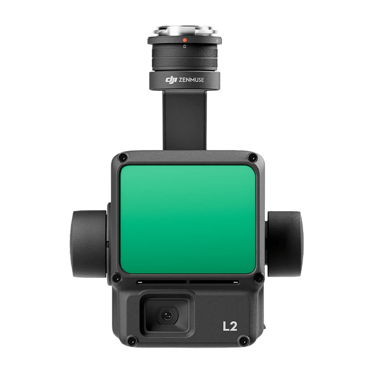
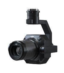
Zenmuse L2 integrates frame LiDAR, a self-developed high-accuracy IMU system, and a 4/3 CMOS RGB mapping camera, providing DJI flight platforms with more precise, efficient, and reliable geospatial data acquisition.
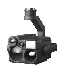
The Zenmuse H20N integrates starlight sensors into its zoom and wide-angle cameras. Pair this with dual zoom thermal cameras and a laser rangefinder, and you have a versatile hybrid payload that rises to the occasion.
The Zenmuse P1 integrates a full-frame sensor with interchangeable fixed-focus lenses on a 3-axis stabilized gimbal. Designed for photogrammetry flight missions, it takes efficiency and accuracy to a whole new level.
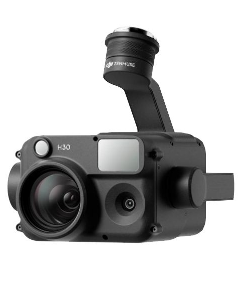
The Zenmuse H30 Series features a high-resolution 40MP zoom camera, supporting up to 34× optical zoom and an incredible 400× digital zoom. Compared to the previous generation, it not only observes subjects at greater distances but also captures more details.
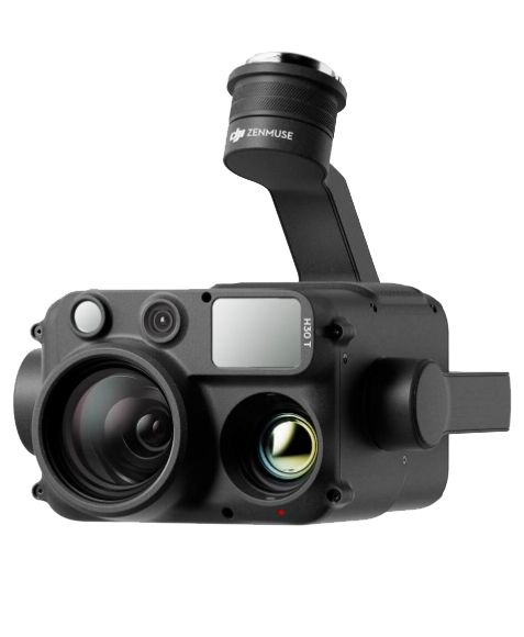
The Zenmuse H30T can switch to Night Scene mode in low-light conditions, enhancing live view and recording quality. This ensures operational efficiency and accuracy at night, enabling continuous operation from day to night.
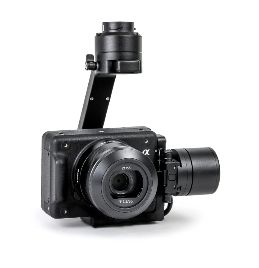
Powered by the Sony A7R Mark IV, RGB61 guarantees maximum coverage, superior accuracy and a lighter data load, while offering in-app light settings control.
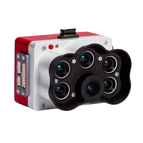
The MicaSense RedEdge Panchromatic (RE-P) is our premium multispectral camera, which combines a panchromatic sensor with five narrow bands to produce high-resolution multispectral and RGB from one flight for advanced analytics.
Optimized to map vertical structures, this 3D mapping camera allows you to generate high-resolution 3D meshes with centimeter level absolute accuracy.
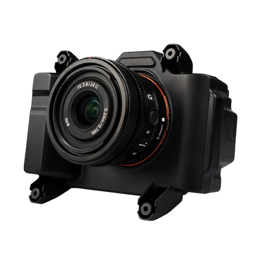
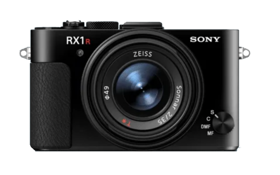
For high accuracy surveys, Sony’s 42 MP full-frame sensor guarantees superior image resolution for a drone camera, while the low distortion lens ensures best reconstruction results.
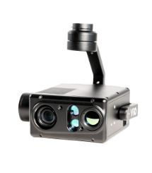
Vio series is an advanced lightweight EO/IR payload, featuring a 4K zoom sensor, a 640×512 radiometric thermal camera, and an integrated 2400m laser rangefinder, ready for various industrial applications.
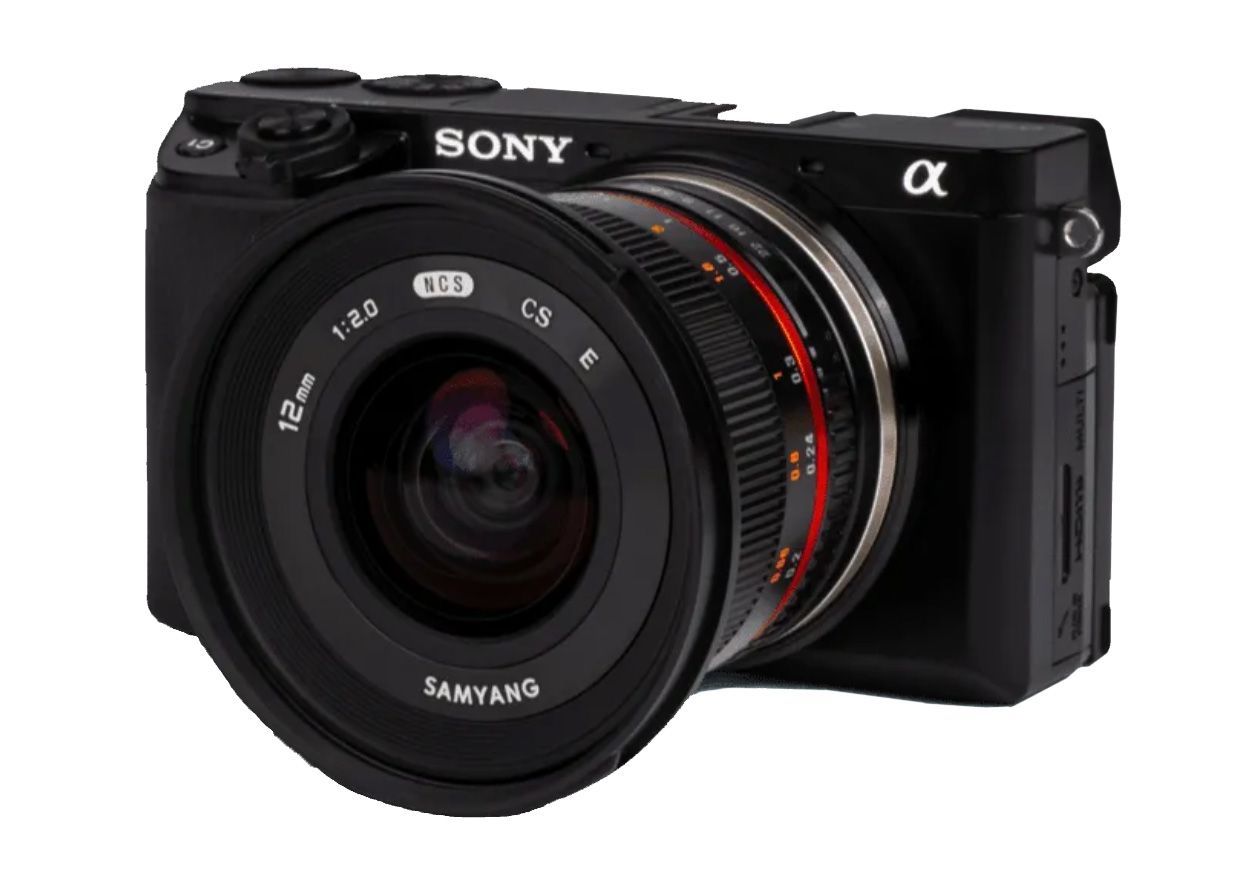
Powered by a 61-megapixel full-frame back-illuminated Exmor R CMOS sensor and the BIONZ XR image processor, the new ILX-LR1 has excellent resolving power, wide dynamic range, and a broad ISO range spanning 100-32000 (native).
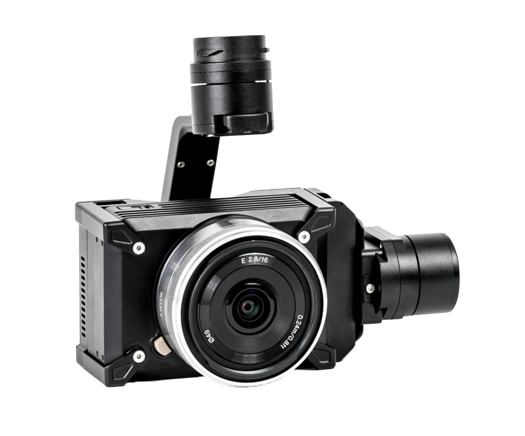
The WISPR 24MP mapping camera is equipped with a full-frame Sony APS-C sensor, boasting an impressive 24.3 effective megapixels for high-resolution aerial mapping.
Zenmuse L2 integrates frame LiDAR, a self-developed high-accuracy IMU system, and a 4/3 CMOS RGB mapping camera, providing DJI flight platforms with more precise, efficient, and reliable geospatial data acquisition.
The Zenmuse H20N integrates starlight sensors into its zoom and wide-angle cameras. Pair this with dual zoom thermal cameras and a laser rangefinder, and you have a versatile hybrid payload that rises to the occasion.
The Zenmuse P1 integrates a full-frame sensor with interchangeable fixed-focus lenses on a 3-axis stabilized gimbal. Designed for photogrammetry flight missions, it takes efficiency and accuracy to a whole new level.
The Zenmuse H30 Series features a high-resolution 40MP zoom camera, supporting up to 34× optical zoom and an incredible 400× digital zoom. Compared to the previous generation, it not only observes subjects at greater distances but also captures more details.
The Zenmuse H30T can switch to Night Scene mode in low-light conditions, enhancing live view and recording quality. This ensures operational efficiency and accuracy at night, enabling continuous operation from day to night.
Powered by the Sony A7R Mark IV, RGB61 guarantees maximum coverage, superior accuracy and a lighter data load, while offering in-app light settings control.
The MicaSense RedEdge Panchromatic (RE-P) is our premium multispectral camera, which combines a panchromatic sensor with five narrow bands to produce high-resolution multispectral and RGB from one flight for advanced analytics.
Optimized to map vertical structures, this 3D mapping camera allows you to generate high-resolution 3D meshes with centimeter level absolute accuracy.
Vio series is an advanced lightweight EO/IR payload, featuring a 4K zoom sensor, a 640×512 radiometric thermal camera, and an integrated 2400m laser rangefinder, ready for various industrial applications.
Powered by a 61-megapixel full-frame back-illuminated Exmor R CMOS sensor and the BIONZ XR image processor, the new ILX-LR1 has excellent resolving power, wide dynamic range, and a broad ISO range spanning 100-32000 (native).
The WISPR 24MP mapping camera is equipped with a full-frame Sony APS-C sensor, boasting an impressive 24.3 effective megapixels for high-resolution aerial mapping.
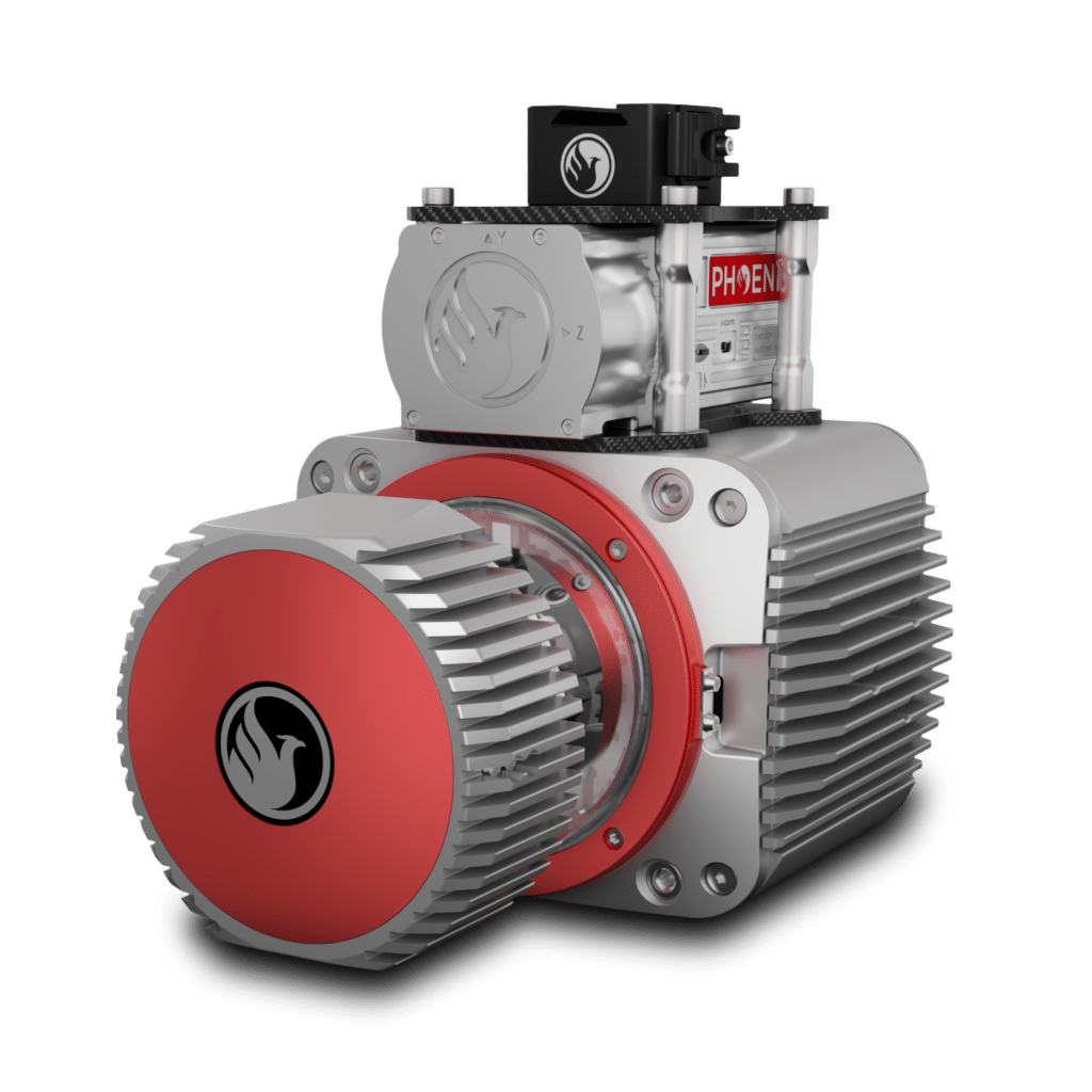
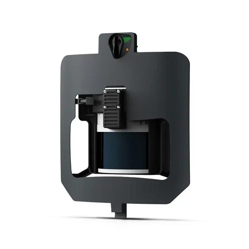
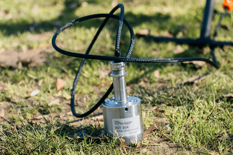
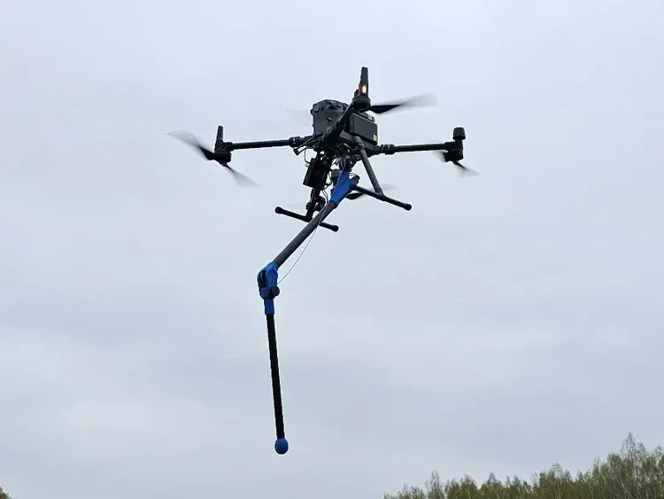
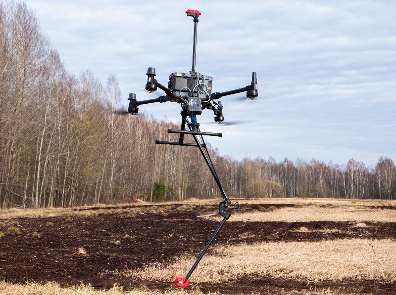
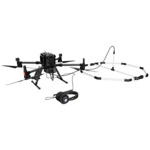
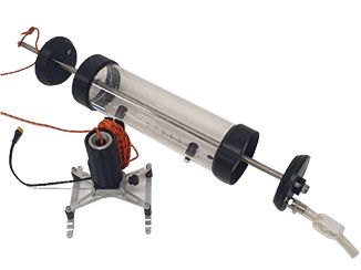
Electromagnetic impulse (EMI) geophysical instrument for conductive materials detection.
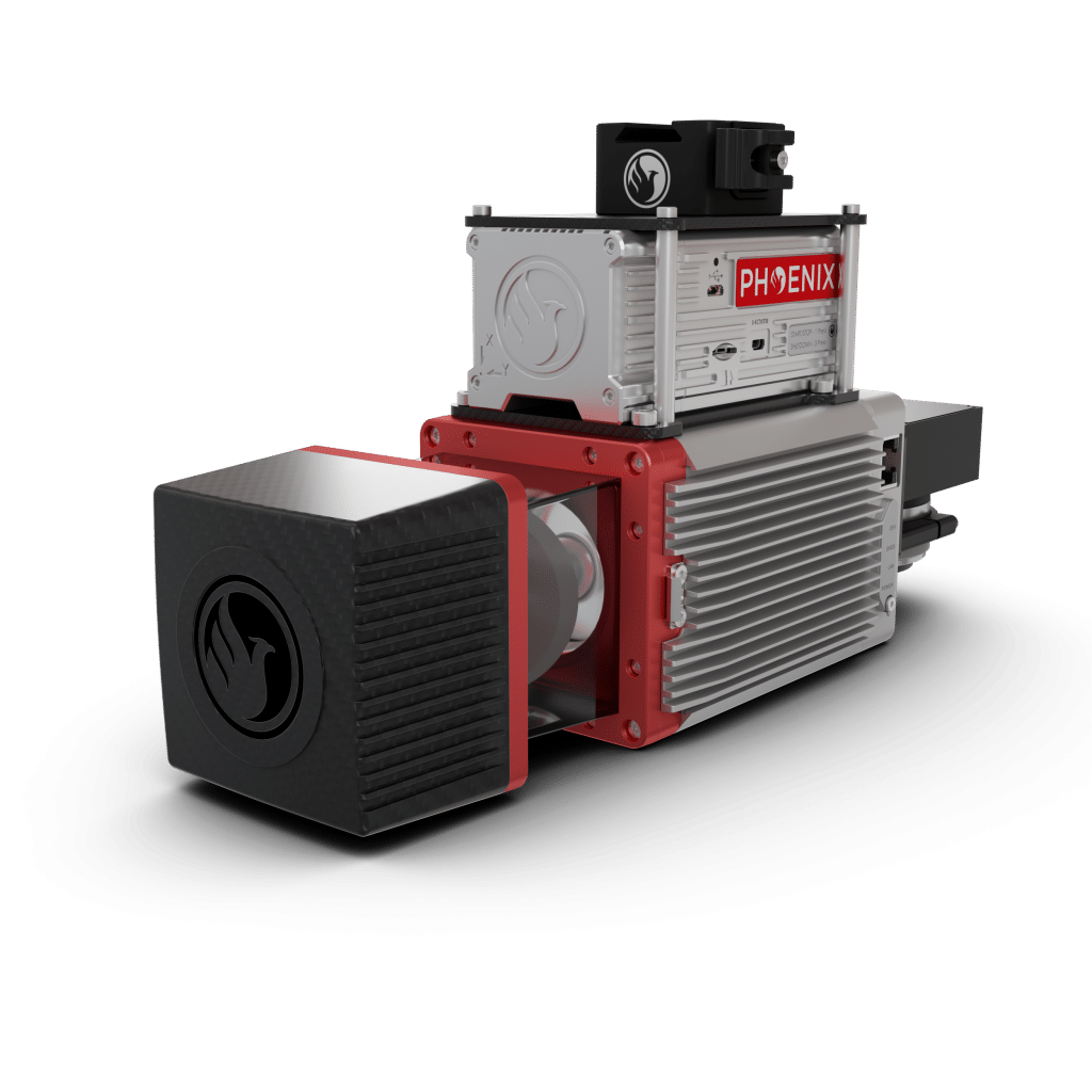
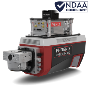
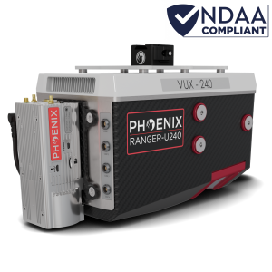
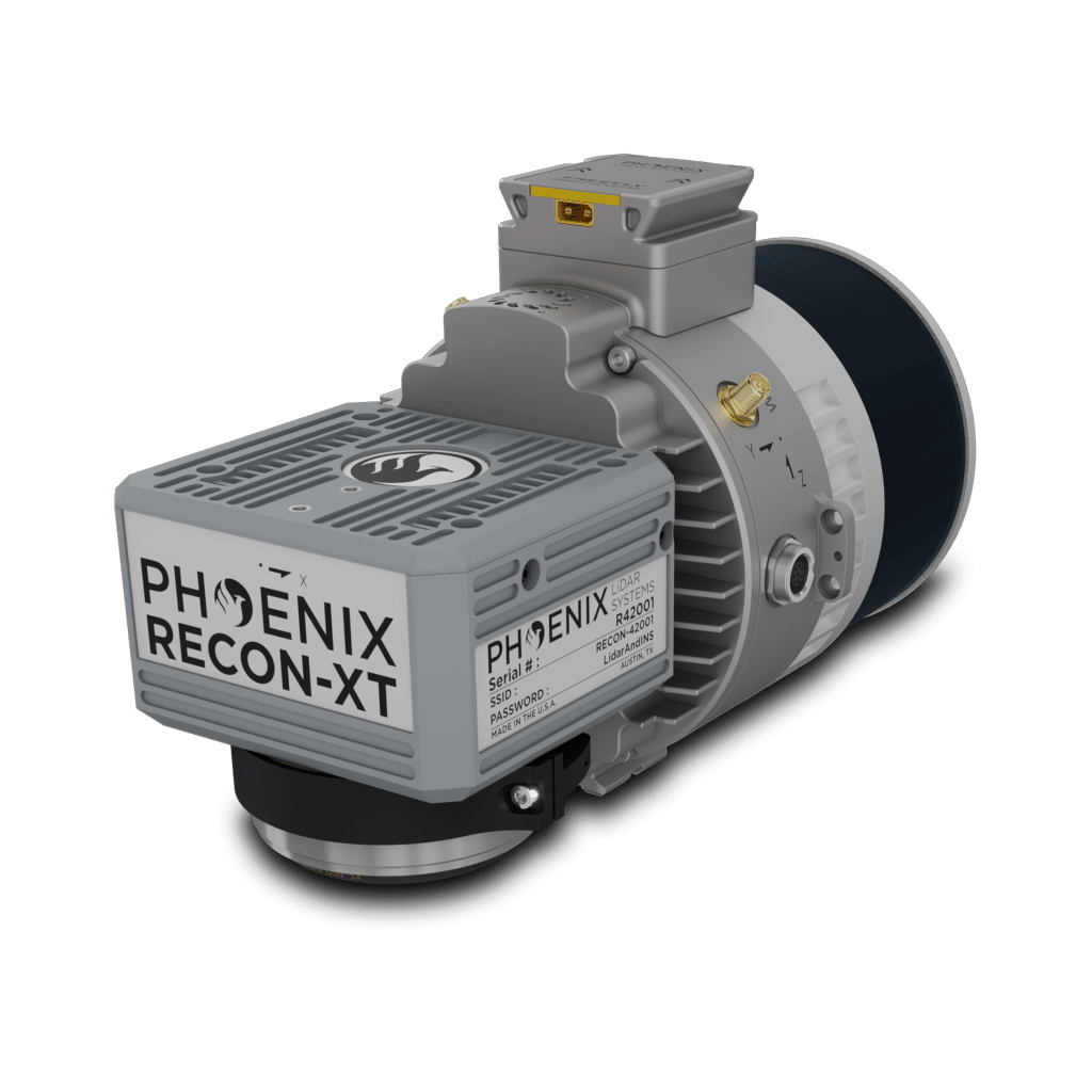
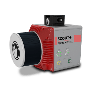
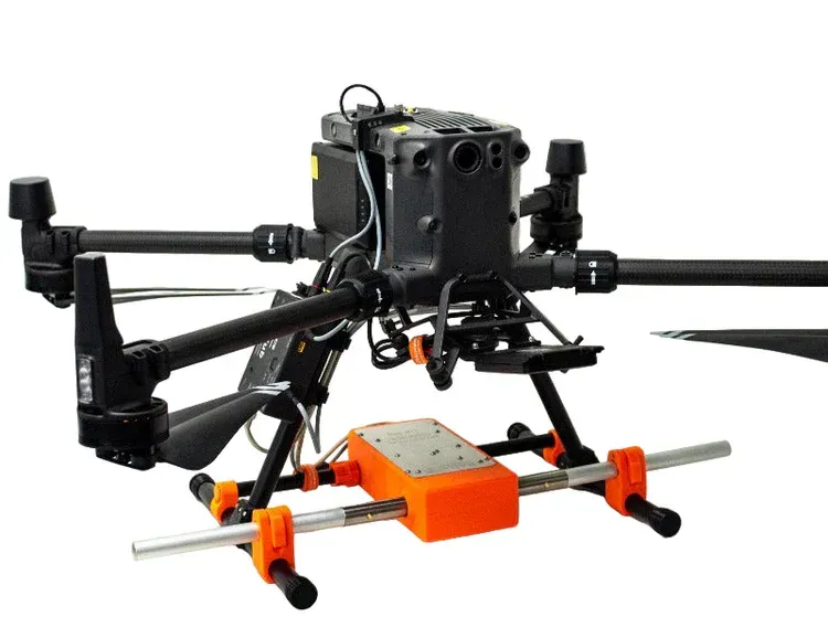
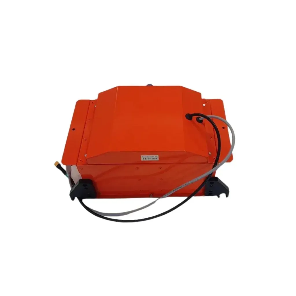
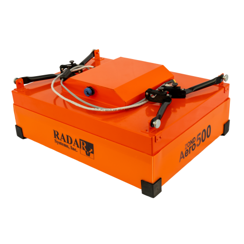
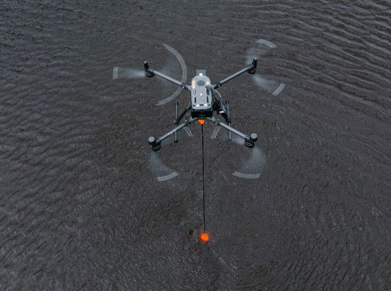
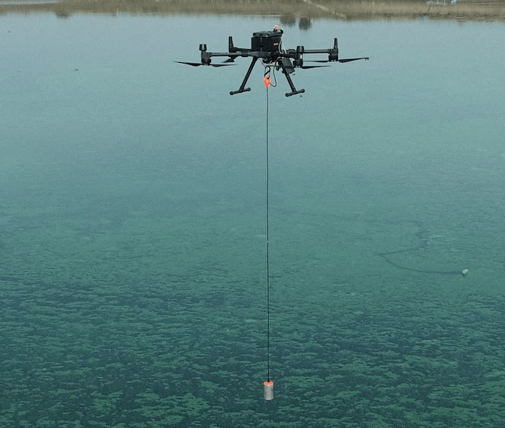
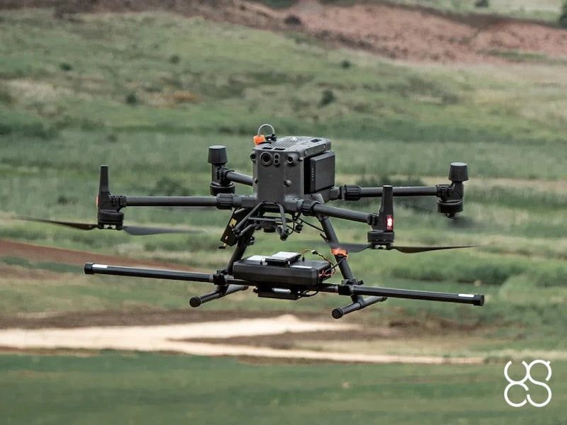
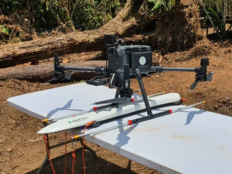
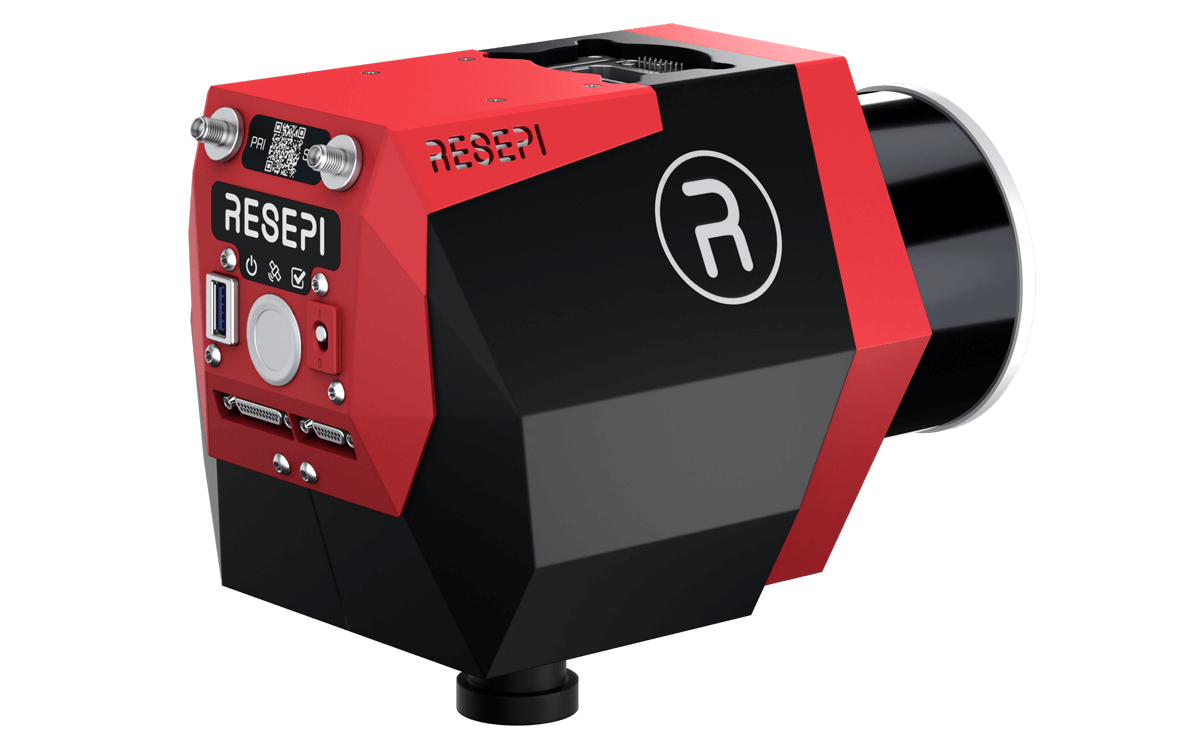
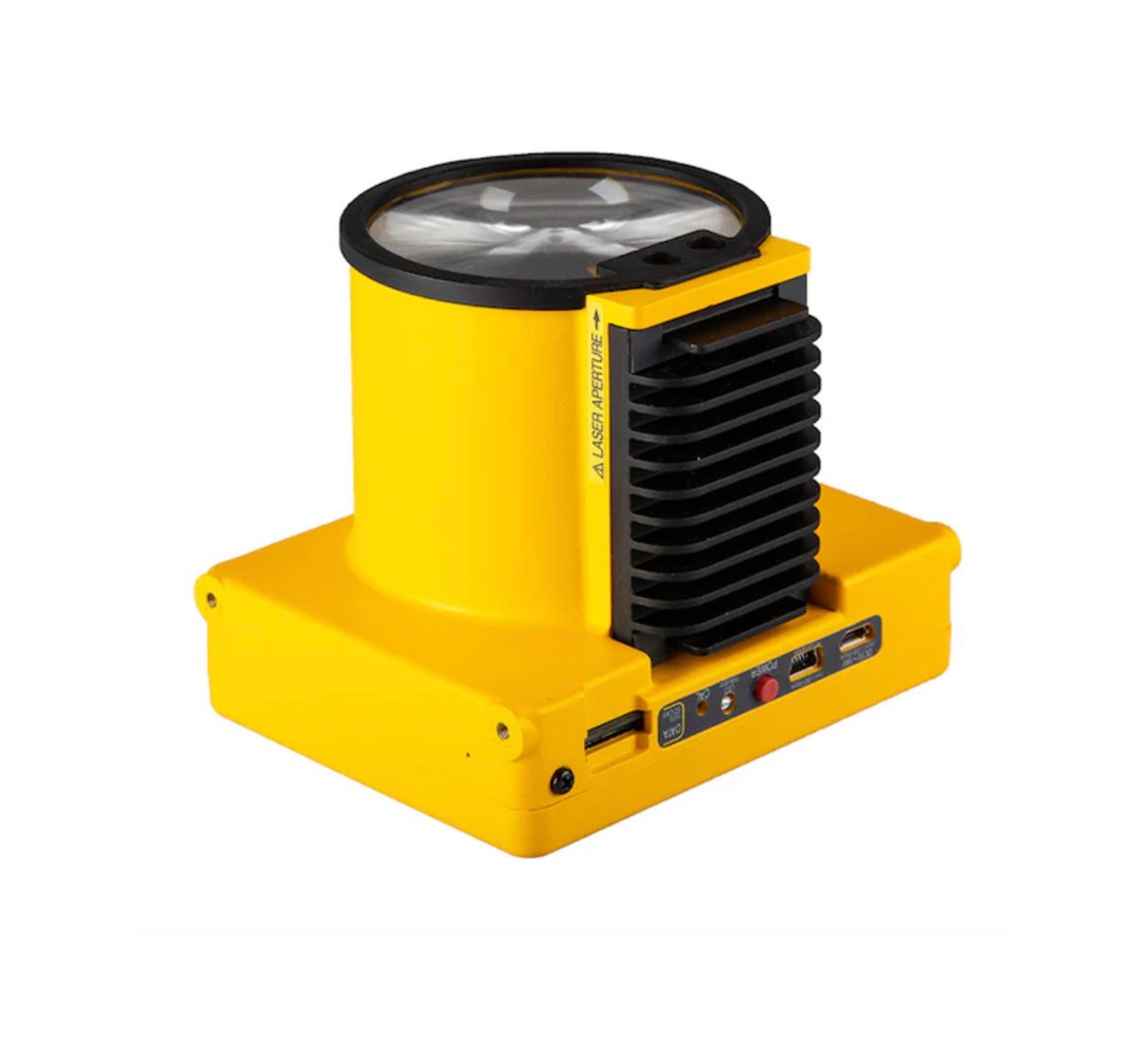
The Remote Sensing Payload Instrument. Compact and light-weight, offers best-in-class data accuracy, good detection range, high point density, and versatility.
Electromagnetic impulse (EMI) geophysical instrument for conductive materials detection.
The Remote Sensing Payload Instrument. Compact and light-weight, offers best-in-class data accuracy, good detection range, high point density, and versatility.
Electromagnetic impulse (EMI) geophysical instrument for conductive materials detection.
The Remote Sensing Payload Instrument. Compact and light-weight, offers best-in-class data accuracy, good detection range, high point density, and versatility.